


 Home

 News

 Blogs

 Podcast

 Photos

 Videos

 Publications
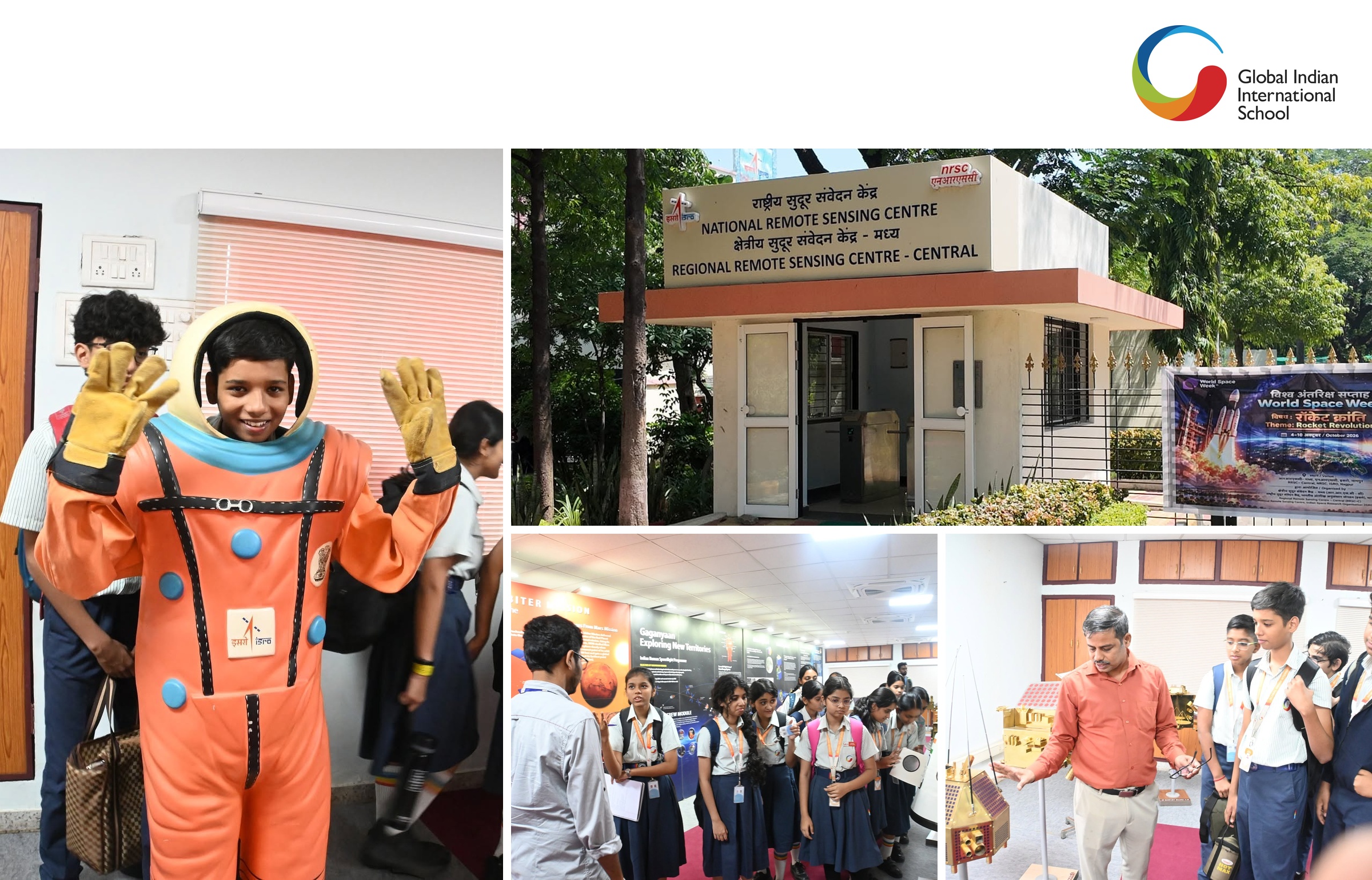


On 5th October 2026, the Grade 9 students of Global Indian International School, Lava Campus, Nagpur, visited the Indian Space Research Organisation (ISRO) as part of World Space Week. The students were warmly welcomed by the ISRO team before settling in for a presentation on India’s space programme, delivered by Milind Wadodkar, a scientist at ISRO. The visit aimed to introduce them to India’s launch vehicles, satellites and space missions, show how space technology serves communication, navigation, education, healthcare and Earth observation, and connect classroom learning with real-life science.
The presentation opened with an overview of the Indian space programme, covering launch vehicles such as PSLV, GSLV and GSLV Mark-III, and exploration missions including Chandrayaan, Mangalyaan and Astrosat. Students learnt that India’s programme is people-centric and self-reliant, that the country is among the top six space-faring nations, and that its remote sensing constellation is the largest operational one in the world. They also explored the geostationary, polar (sun-synchronous) and low-inclination orbits, and why each is chosen for a particular task.
The students then learnt about the Indian satellites in service. Fourteen satellites, including the INSAT and GSAT series, orbit at geosynchronous altitude with over 200 transponders in the C, Extended C and Ku bands. These support telecommunication, television broadcasting, weather forecasting, disaster warning, and search and rescue. On satellite navigation, they were introduced to GAGAN, which supports civil aviation and air traffic management, and NavIC, an independent system of seven satellites that provides position, navigation and timing services over India and its neighbourhood.
The session also showed how space technology touches everyday lives. EduSat connects a teaching end with remote classrooms for tele-education, while satellite tele-medicine links 180 hospitals, 146 of them district or rural and 34 super-specialty, to specialist doctors, truly “reaching the un-reached.” Students followed the growth of Indian imaging satellites from Bhaskara to the IRS, Resourcesat and Cartosat series, with image resolution improving from about 1 km to 1 m. They also saw how satellite images are used in mapping and monitoring natural resources, environmental applications, disaster management, rural and urban development, and utility management.
After the presentation, the students visited the ISRO museum, where models of space vehicles, satellites, rockets and space suits are displayed. They were given information about each exhibit, which helped them relate what they had heard to real space hardware.
The students came away with a clear understanding of how rockets, satellites and ground systems work together, and how satellite technology reaches people in daily life. They also gained an appreciation of India’s self-reliant space achievements.
The visit to ISRO was an informative and inspiring experience for the Grade 9 students, and one that made classroom concepts real and deepened their interest in space science.
- 0
- 0
Comments ({{totalComments}})
Login to post a comment...
{{comments.CommentText}}